Roads & Highways
In a similar fashion to the B&O Railroad, roads and highways played a significant role in the development of the Village of Jessup. U.S. Route 1 and the Baltimore-Washington Parkway played the largest historical roles, but additional roads and highways have also shaped the community.
U.S. Route 1
Historically U.S. Route 1 has been in constant use for almost 300 years. It was hardly more than a trail possibly started by the Indians. Originally it was narrow, dusty or muddy, full of ruts, stumps, hills, curves and detours. In 1704, a mandate required all roads to be 20 feet wide, and this road was widened and increased to a 60-foot right of way by 1820 from Baltimore to Georgetown.
U.S. Route 1 was the main north-south route for stagecoach transportation, with a main stop in Waterloo, now part of Jessup and the intersection of what is now Route 175.
Ownership of Route 1 was changed from the County, to the State, and then the Nation, probably a factor of the expense of keeping this major artery under repair. By 1925, it became part of U.S. Route 1 (Maine to Florida), and three years later was widened to four lanes. By 1934, there was an average of 39 billboards to the mile and a few years later an average of 18,000 cars and trucks passing Jessup daily. This volume created a nightmare for the village because of the build up along the roadsides. It’s been said that it was the heaviest traveled and deadliest stretch of road in the world.
The Baltimore – Washington Parkway
The Baltimore-Washington Parkway was the answer to the problems encountered on U.S. Route 1. In 1951, residents began to see construction activity, but the Parkway was not completed until 1955. In order to make this extensive highway possible, land had to be purchased from Jessup residents.
The 19 miles from Washington to Jessup was built by the Federal government while the section from Jessup to Baltimore was built by the State of Maryland. Originally, the Federal portion was built for cars only because the concrete was only 8 inches thick. The State portion was made of 10 inch thick concrete and would carry cars and trucks. To this day, all trucks must exit the Parkway at Jessup on Route 175 if they are heading south. At the time the BW Parkway was called the “million-dollar-a-mile road” because of the cost. The cloverleaf built to accommodate the Parkway changed the entire appearance of Jessup and continues to cause many traffic-related and other problems to this day.
Two very old structures had to be demolished to make way for the project. One was St. Mary’s Episcopal Church and the other the home of the Clarke family. This home was one of the oldest in the community and both structures were built sometime between 1860 and 1878.
Old Annapolis Road
Old Annapolis Road is probably the most significant thoroughfare affecting Jessup. It is now called State Route 175, originally running from Ellicott City, crossing Route 1 at Waterloo, continuing through the heart of Jessup, crossing the Baltimore-Washington Parkway, through the edge of Fort George G. Meade and terminating in Annapolis.
It’s accepted fact that originally the road was an Indian trail and that George Washington took this road when going to Annapolis as it branched off Route 1 that ran north to south between Washington and Baltimore.
In 1910, Anne Arundel County had slag from the Muirkirk Furnace brought to Jessup via rail car to serve as a base for the road. The road bed slag extended from the railroad about 3 and a half miles east. The State took over the road in 1929 and made it a concrete road. This attracted vehicular traffic, especially with the conversion of Camp Meade, a Civil War and World War I installation to Fort Meade.
Brock Bridge Road
One mile east of the railroad, turning from Route 175 in a southerly direction, is an old road with a new name. Brock Bridge Road, formerly known as Annapolis Junction Road, was non-existent on Martenet’s map of 1860. However, land deeds show that Enoch Pratt and his wife Maria Louisa Pratt deeded a parcel of land to John W. Biggs in exchange for a road and 5 dollars.
Dr. Asa Linthicum, a relative of the Linthicum family of Maryland, had a private road leading from his iron ore mines to the main road (Route 175) and the new portion was to extend toward Annapolis Junction. There was also an undetermined transaction between Dr. Linthicum and Enoch Pratt. This was the beginning of Brock Bridge Road.
The road not only afforded an exit for the Linthicum and Hobbs iron ore mines, and timber from the Hayes and Dashiell saw mills, but it was a direct route to the railroad at Annapolis Junction. The Washington, Baltimore, and Annapolis Railroad was the only public transportation to Annapolis. After being called Annapolis Junction Road for over a century, it was renamed Brock Bridge Road in 1961 and given a new blacktop surface in 1965. It took the name because a portion of road from Annapolis Junction to Laurel and beyond Maryland City had been known as Brock Bridge Road for years.
Dorsey Run Road
Another road that runs from Jessup to Howard County is Dorsey Run Road. Before it was named such in 1955, it was known locally as Tomato Road, because farmers from Howard County hauled tomatoes to one of three canneries which were located in Jessup.
Montevideo Road
Montevideo Road starts at Race Road and meanders through Montevideo, crosses Forest Avenue and comes to an end at Washington Boulevard (Route 1).
Forest Avenue
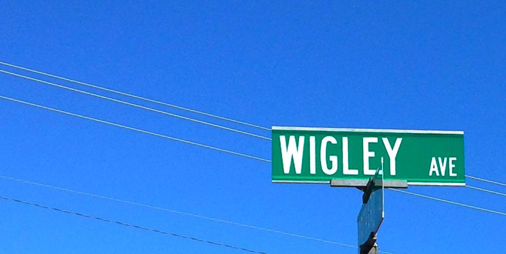
Forest Avenue extends from Montevideo Road to Dorsey Road (Route 176) just southeast of the railroad. In the mid-1930s the road was cut through a forest – hence the name – with the intention of transporting Montevideo children to Dorsey School. Forest Avenue was extended in 1964 to Route 175 with the help of Henry Wigley, the County Commissioner of Anne Arundel County, and the extension was named Wigley Avenue in 1966.
Race Road
Race Road is one of the older roads in Jessup. It is shown on early maps. It was moved during the construction of the Baltimore Washington Parkway because of the cloverleaf and placed opposite Sellner Road. Older residents tell the story that this used to be “Mill Race Road” and was used by farmers hauling grain to the mill. The true location of the mill is undetermined but believed to be on the east side of Dorsey Road on Deep Run.
Ridge Road
Ridge Road is shown on maps from 1860 and 1878 and extended from Route 175 to “Elkridge Landing.” Elkridge Landing was a thriving port on the Patapsco River and this was probably a very heavily traveled road.
There are other shorter roads that were constructed to accommodate the growing number of people that built homes in Jessup.